The radius field provides the accuracy confidence metric for IPinfo’s IP geolocation data

The radius field is available in our IP to Geolocation Extended Database. The radius metric provides a metric for our confidence in the accuracy of the IP geolocation data row by row. The radius field is calculated from the geographic coordinate value from the IP geolocation database.
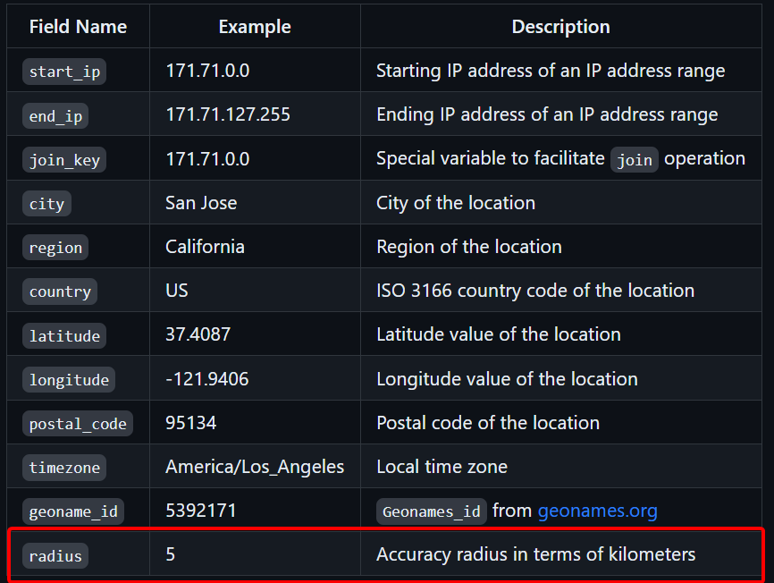
The radius field is measured in kilometers. The lower the radius number is, the more we are confident we are accurate. And vice-versa.
![]() Check out the documentation and data schema for the IP to Geolocation Extended database.
Check out the documentation and data schema for the IP to Geolocation Extended database.

How do we calculate the radius value?
The radius value is a statistical value derived from comparing our geographic coordinate values in our IP geolocation database with our Ground Truth data. Ground truth data points are verified device location data points.
Why the radius field can have high numbers?
Carrier IPs tend to have a higher radius value as mobile phones can be used across a large distance. Some organization-based IP addresses can be difficult to geolocate as they can be used in different regions via VPN. And IPv6 is generally difficult to geolocate because of its sheer volume in an allocated range.
How can the radius field have a very low number?
IP addresses of data centers, public organizations, and government buildings can be pinpointed down to their geographic coordinates. They usually have the lowest accuracy radius.
Requesting the database
The IP to Geolocation Extended database can only be requested as a custom database: Contact Sales - IPinfo.io